Ottoman Geographers with Dr. Gottfried Hagen

Yunus Emre Institute in Washington has put its signature under a brand new program in the speech series organized about the Ottoman Empire.
The Yunus Emre Institute in Washington D.C. relaunched its Humans of the Ottoman Empire talk series due to popular demand. This series explores the people and social groups that lived in the Ottoman Empire. Dr. Hagan, who works on Turkish culture at the Department of Near Eastern Studies at Michigan University, attended the event moderated by Cengiz Şişman.
Dr. Sisman interviewed Dr. Hagan about how the Ottomans studied and understood geography and cartography.
FIRST REGIONAL MAP MADE IN 1803
Dr. Hagan revealed that geography was not a formal area of study in the empire, but that it was related to several other fields at the time. Geography was tied to astronomy, an important science in the Middle East in the medieval period due to navigation and religious practices. The Ottomans also understood geography through historical narratives of the region and their state. Travel accounts and maps were occasionally influenced by legends such as the Piri Reis map. Geography and cartography were very rare fields restricted to the elite in society; the lower and middle classes would not have had access to maps or specific skills such as making land surveys. The Ottoman Empire was typically described with travel narratives and ethnographies versus making territorial maps. The first dedicated territorial map was produced in 1803, several centuries into the time of the empire.
LEGENDS ON THE PIRI REIS MAP
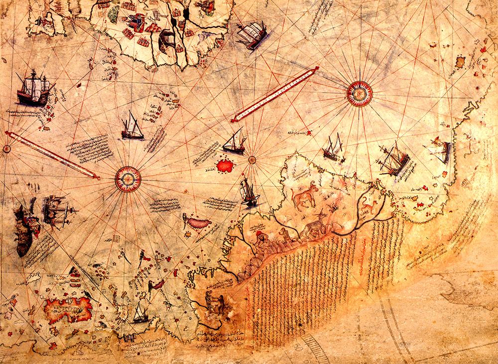 A number of guests engaged with the discussion by asking questions that they formed while watching the event. One audience member asked about mythological creatures like the unicorn like creature depicted as living in Brazil on Piri Reis’ Ottoman map from 1513. Dr. Hagen clarified that the creatures are from old fables and stories, emphasizing the creativity cartographers had when making their maps. Dr. Hagen and Dr. Sisman both elaborated that storytelling played an integral role in the creation of maps and their geographical examination of the empire.
BENEFITED FROM OLD AND NEW KNOWLEDGE
Another question from the audience was about whether the Ottomans encountered other traditions of geographical studies. Dr. Hagen answered by carefully explaining that the Ottoman Empire drew from the mapmaking and geographical knowledge of the previous Persian and Arabian empires. In addition, Dutch and Italian maps circulated in Istanbul, and their traditions influenced Ottoman geographers in the late 16th and 17th centuries. Many audience members thanked Dr. Hagen and Dr. Sisman for their careful charting of Ottoman history.
Diğer Etkinlikler

 in Lefkoşa, was held on March, 28 2024 in the Turkish Republic of Northern Cyprus (TRNC).")